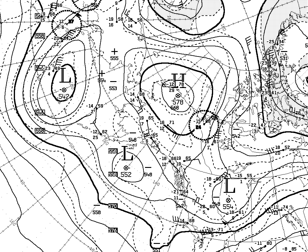
The heat is back for interior Alaska, and this time with a focus on the north, especially the northwest. A strong high pressure ridge has set up squarely over the North Slope and will intensify even a bit more into tomorrow morning before fading. Here's the 500mb analysis from 4pm AKDT yesterday, courtesy of Environment Canada:
Mid to high 80s Fahrenheit have been reported from many sites around the northwestern interior and the southern slopes of the Brooks Range, but most of these are RAWS sites that are known to run hot on sunny summer days. There was a credible 88°F at Huslia airport, however, on Wednesday.
More significantly, I think, there was a daily minimum temperature of 72°F at an elevated RAWS site about 40 miles north of Kotzebue, i.e. well above the Arctic Circle. I think there's no reason to believe this temperature is too high, as there is no solar insolation in the early morning hours: the "midnight" sun is blocked by terrain to the north.


No comments:
Post a Comment