Tuesday, April 26, 2011

Still Chilly on the Slope


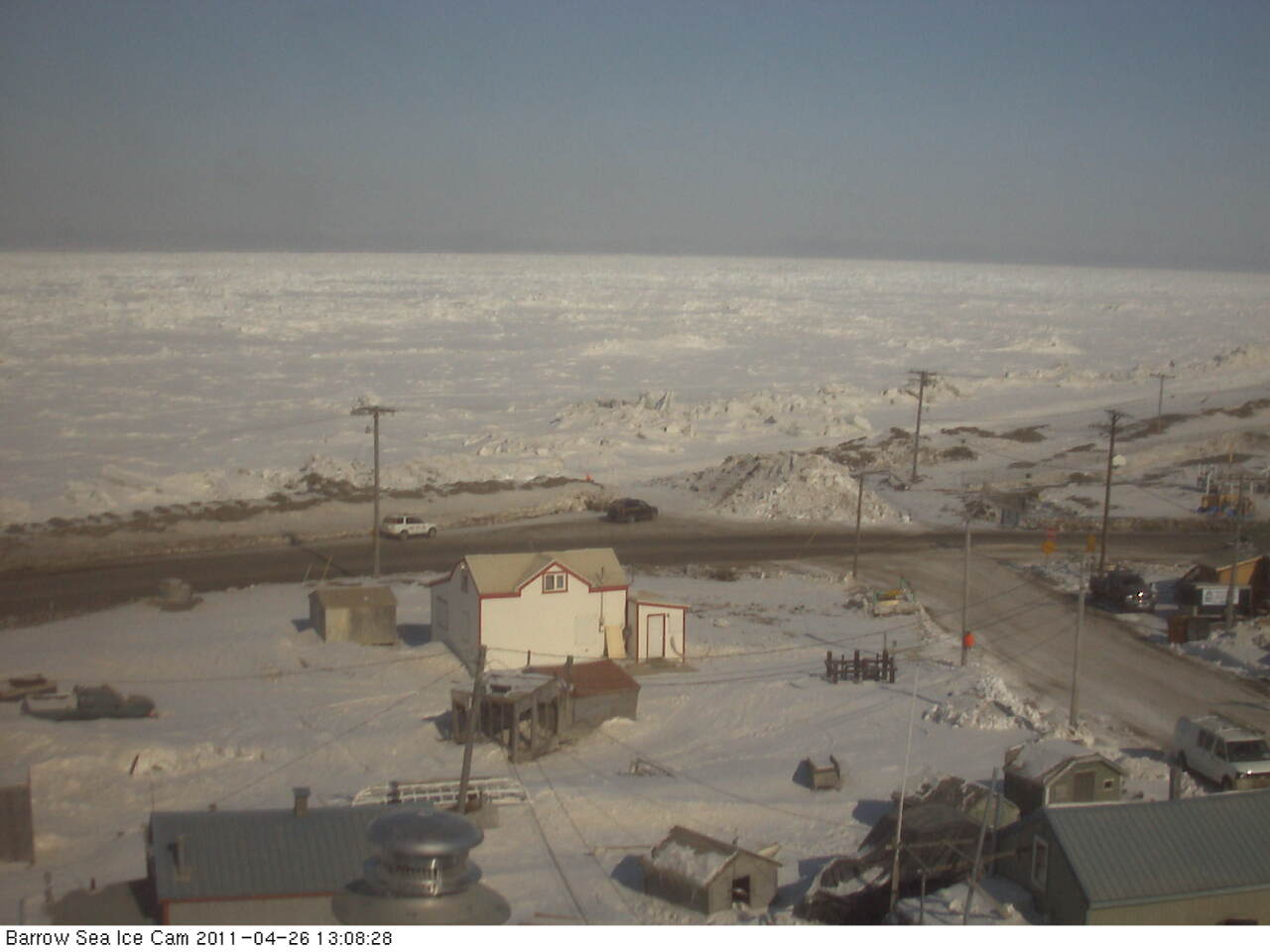
Parts of the North Slope dropped well below zero this morning. Lows included 20 below at Umiat and 13 below at the Ikpikpuk River gauge and Deadhorse. Barrow hit 10 below. This is nowhere near record lows: the record today at Barrow is 27 below set in 1924, and based on a much shorter period of record, the record low at Umiat for April 26th is 35 below in 1949. Photo from Barrow Tuesday afternoon looking northwest. Courtesy of the UAF Sea Ice Project

Sunday, April 24, 2011

Going…Going…


Snow depth at the Fairbanks Airport was down to 4 inches as of 4am Sunday morning. With a high temperature again near 60 today, either April 24th or 25th will be the last day with measurable snow cover. At the left is a plot of meltout dates for Fairbanks since 1930. I have adjusted for leap years in this plot. The red line is the five year running mean. Several things stand out here. First, over the full 82 years of data there is no trend. There is a cluster of early dates centered around 1940 and a cluster of late dates centered in the early 1960s. Claims of a trend toward earlier snowmelt based on the Fairbanks data are an artifact of starting the regression later than 1945 or so. Second, since the mid 1970s there is not much of a trend at all, though the lack of very late dates in the past 20 years is becoming noticeable.

Saturday, April 23, 2011

First 50 Degree Day

At noon at the Fairbanks Airport the temperature was 51F. This is the first 50 degree temperature since October 3rd. Hasta la vista, snow cover.

Alaska: it's not all the same


On the theme of the amazing difference between hills and valleys in Interior Alaska, here is a blast from the past. This composite photo is from September 2009. The bottom photo when I left home to go to work. The top photo when I got to UAF 30 minutes later. It isn't just that it was snow in the hills and rain in the valley. In fact, there had been very little precipitation at valley level.

Thursday, April 21, 2011

Snowmelt


The winter snowpack is going quickly now at low elevations. The snow at the Airport observing site is down to 10 inch depth and is increasingly patchy. Over the past 20 years, once the snow depth is down to 10 inches at the airport, it takes 4 or 5 days on average to melt out. Here on Keystone Ridge, it's a different story. There has been no loss of snow cover at all except right around the house. Here's a photo of the weather station from Thursday morning.

The forecast is for a substantial warm-up starting Friday, with highs in the 50s at valley level for the foreseeable future, and night time lows near freezing here on the ridge. This will chew up the snow in a hurry.

Tuesday, April 19, 2011

Sustained Temperature Anomalies


Here are plots of temperatures over the past year (through April 17) for Barrow and Fairbanks, courtesy of the Climate Prediction Center.

Of particular interest is the middle plot on each graphic. This is the 31 day running mean, so it smooths out the day to day variation and brings out the longer term patterns. The persistence of warmth at Barrow since last summer, and the mostly below normal temperatures at Fairbanks since December are obvious.

Sunday, April 17, 2011

Spring in Fairbanks


Sunday morning view in downtown Fairbanks, overlooking the Chena River. The snow on the south facing bank of the is going, while the ice on the Chena remains solid.

Wednesday, April 13, 2011

Still Winter on the North Slope


Another chilly morning on the North Slope. Lows Wednesday AM include:

Umiat: -34F
Ivotuk: -32F
Galbraith Lake: -22F
Atqasuk: -22F
Nuiqsut: -22F

This morning's NOAA-19 infrared image from 619AM shows the clear skies. Southwest of Umiat, in the upper Colville River drainage, is an area with surface temperatures around -40F. Not bad for mid-April.

Monday, April 11, 2011

When will the snow melt?

As of Monday morning, there was 19 inches of snow on the ground at the Fairbanks Airport.
This is somewhat above median for the date, and so how does this bode for melt out?

In the past 30 years, the Airport has had 19 or more inches of snow on the ground on April 11th seven times. Here are the years and the date of melt out (first day without measurable snow on the ground):

1985: 31 inches: May 9th
1989: 21 inches: April 25th
1991: 46 inches: May 7th
1992: 30 inches: May 7th
1993: 23 inches: Apr 24th
2000: 20 inches: April 27th
2009: 23 inches: April 29th
2011: 19 inches: ?

Based on just this small sample, you'd expect that 1) melt out will be later than the long term average of Apr 20th and 2) sometime in the last week of the month is the most likely.

Sunday, April 10, 2011

North Slope Spring


It's a lovely early spring weekend on the North Slope. Along the coast, temperatures in the teens below with 10 to 20 mph winds. Inland, light winds and cold. Through 6am Sunday, low temperatures include 33 below at Ivotuk, southwest of Umiat, 27 below at Umiat and Sag River and 24 below at Anaktuvuk Pass. Here's the web cam photo from Saturday evening at Umiat.

Updated: low at Umiat was -28F

Saturday, April 9, 2011

Spring Evening at Barrow


From the Sea Ice group at UAF, the view to west from Barrow 10:07pm Saturday. whaling season is approaching.

Thursday, April 7, 2011

Big Storm Churns On


The monster storm in the Bering Sea has brought a variety of not so spring-like weather to a large chunk of Alaska, with some details in this News-Miner article. The wind damage at False Pass is noteworthy, as being at the western end of the Alaska Peninsula they often gets strong winds. Here in Fairbanks-land there has been a little snow, but no great shakes.

The 4am ADT analysis shows the storm has started to weaken, but it's still packing a punch. At 10am ADT this morning St George, in the Pribilofs, reported a peak wind of 76 mph. The NOAA bouy (46045) that is a couple hundred miles west of the Pribilofs recorded a minimum measured pressure of 940.0mb at 9pm ADT Wednesday.

Update: Cold Bay wound up with a peak wind of 91 mph.

Wednesday, April 6, 2011

Big Storm


Here is the 4pm ADT Wednesday surface analysis from the Ocean Prediction Center. Offhand, I cannot recall such a deep storm in the Bering Sea in April. The major impact in Fairbanks-land will be to bring milder temperatures Thursday and Friday. Closer to the low center, both Atka and Adak reported a maximum wind gust of 72 mph Wednesday afternoon.

The Big Plunge


Here is an hourly temperature plot here on Keystone Ridge over the past day: as of 10am ADT Wednesday, it's running 25 degrees colder than 24 hours previously. The big plunge has been accompanied by gusty northwest winds and some light snow.

It will not last though; the models have been consistently forecasting it to warm right back up tomorrow (Thursday), as sometimes happen this time of year.

Saturday, April 2, 2011

Interesting March Factoid


March had the greatest average daily temperature range of any month of record in Fairbanks.
The average high was 25.4 and the average low was -10.8, for a mean diurnal range of 36.2 degrees. At the Goldstream Valley Coop site, the mean range was a stunning 43.6 degrees (29.5, -14.1).

Here on the ridge, the mean range was an almost exactly normal 14.0 degrees

This illustrates both the power of the sun and the efficiency of radiation cooling.

Friday, April 1, 2011

Nippy Start to April

Temperatures bottomed out as expected Friday morning. Low temperatures in the valleys included:

Fairbanks Airport: -15F
Goldstream Creek: -19F
Woodsmoke: -19F (near North Pole)
UAF West Ridge: -9F

Lows mostly just above zero at higher elevation, including+3F here on Keystone Ridge. As usual this time of year, the air mass will quickly moderate, so after a chilly night tonight, temps should be back to near or slightly above normal.