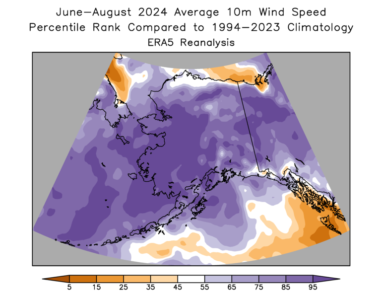
Looking back at climate anomalies for June through August, the summer as a whole was wetter and slightly cooler than the 1991-2020 normal statewide - but with lots of variability in both time and space. Here are my usual percentile rank maps based on ERA5 and NCEI data:


The contrast between east and west was substantial, especially for precipitation, and of course there was a dramatic difference between June and the rest of summer: June was very warm and dry, but it was followed by the wettest July on record statewide. August continued the wet theme in the west and north, and was very cool in the southwest, but it was dry, sunny, and quite warm in Southeast Alaska:


All in all, it's notable that the North Slope climate division had its second wettest summer on record (1963 was wetter), and the West Coast and Central Interior divisions were third wettest; this is more remarkable after the dry start in June.
June-August temperatures were not especially notable anywhere owing to the big sub-seasonal contrasts. The Bristol Bay climate division did have its coolest summer since 2012, but that's not saying a whole lot, because the past decade has been so warm:

It's quite interesting to inspect the time variability of temperatures during the season, courtesy of UAF's statewide temperature index. Back in June, which ended up being much warmer than normal, the statewide temperature varied on a time scale of a few days, and without a great deal of volatility; but the generally cool pattern in July and August was punctuated by some enormous swings to the warm side:


No comments:
Post a Comment