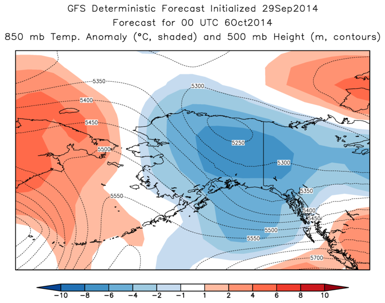
The medium-range forecast for interior Alaska has taken on a cold look in the past few days and is now showing a cold upper-level trough being carved out over the state by the weekend. If this verifies, it would bring daytime high temperatures near or below freezing in Fairbanks and of course a good chance of accumulating valley-level snow. According to the long-term average, the establishment of the permanent winter snowcover is still more than two weeks away, but it can happen in early October - for example, the 2000-2001 winter snowpack arrived on October 5.
The maps below show the ECMWF and GFS model forecasts of 850 mb temperature anomaly (shaded) for Friday afternoon, along with the 500 mb height (dashed lines); the models agree in showing temperatures more than 6 °C below normal over parts of the interior. Of course, this is still 5 days out, so the details will undoubtedly change.

No comments:
Post a Comment