44F at #Barrow Monday is a daily record and a new record high temp for October. Old Oct record 43F in 1925 & 1954 #akwx @Climatologist49— Rick Thoman (@AlaskaWx) October 11, 2016
Monday was the warmest Oct day ever in Barrow with a high of 44ºF. The previous Oct record was 43ºF set 10/10/1925 and tied 10/3/1954. #AKwx pic.twitter.com/ia4Za5pWRm— NWS Fairbanks (@NWSFairbanks) October 11, 2016
More #Barrow records: warmest first 10 days of Oct, mean 33.9F. No days high ≤32F yet this fall, latest of record #akwx @Climatologist49— Rick Thoman (@AlaskaWx) October 11, 2016
October 11th: no snow on ground & no sea ice at #Barrow. 1998 only other year with zero SOG this late #akwx @Climatologist49 @DaveSnider pic.twitter.com/CyGXL7zPuK— Rick Thoman (@AlaskaWx) October 11, 2016
To facilitate the comparison to how things used to be, I created climatological normals of daily high and low temperatures for 1961-1990 and 2002-2015; October of 2002 was the first in the modern run of very warm Octobers. The chart below shows that the daily normals have risen for just about every day on the calendar, but the difference in October is most profound: from October 1 through October 29, the 2002-2015 normal low temperature is higher than the 1961-1990 normal high temperature.
Looking at the variance of daily temperatures, we find that the magnitude of daily variations has become much smaller from mid-September all the way through mid-winter, and this is especially true for daily maximum temperatures. The peak percentage difference occurs on October 10, when the standard deviation of high temperatures has dropped by over 50% between the two periods shown here. This is easy to understand physically: with sea ice now far to the north in October, it's just about impossible to get cold air into Barrow, so the lower part of the temperature distribution has been eliminated.
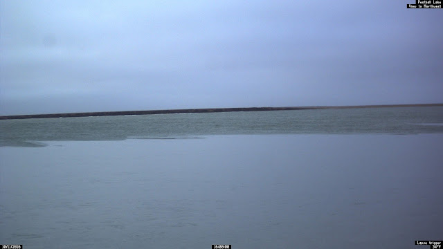
Here are some webcam photos from northern Alaska this afternoon, showing the relatively balmy scene.
Toolik Lake is still mostly open:
There's no snow on the ground at Kavik:
Teshekpuk Lake remains unfrozen, with bare tundra on the shore:
And there's just a little ice on one of the small lakes adjacent to Teshekpuk Lake:
Evidently the Colville River remains largely unfrozen at Umiat as well:


Didn't an analysis on this blog a couple of years ago show that the warmth on the North Slope was related more to warmth advecting from the south than the lack of sea ice? Perhaps I can find it later.
ReplyDeleteEither way, it's crazy to think that Octobers are really that much warmer in the last couple decades. Of course, the Interior has been relatively warmer too. I think I hear the sound of ice storms in the near future.
Good memory, Eric - here's the post:
Deletehttp://ak-wx.blogspot.com/2014/08/autumn-warming-part-2.html
Both effects are involved - there's no doubt the open ocean provides a large warming influence - but the circulation pattern has definitely favored southerly flow in recent years.
Eric,
ReplyDeleteLooking at the GFS model (about a week and a half out) and it's showing a possible ice/rain storm as winds will be out of the southwest and quite brisk. Further in the model the typical southerly flow returns and the interior is rain shadowed out. We will have to watch and see if this plays out.