I promised to follow up with a few remarks about the wet pattern that has become a recurring theme of early spring (March-April) for western Alaska since 2018. Rick Thoman pointed out this phenomenon on his blog:
https://alaskaclimate.substack.com/p/is-early-spring-precipitation-higher
As I commented briefly before, it seems pretty obvious that the immediate cause of the wet weather is the vigorous jet stream and storm track into western Alaska caused by a persistent ridge over the North Pacific. Here's the March-April 500mb height departure from trend, averaged over the last 7 years.
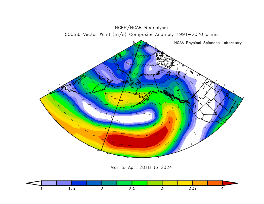
And here's the average 500mb vector wind anomaly (departure from normal): note the stronger than normal westerly flow into southwestern Alaska.
I decided to look back prior to 2018 for an independent assessment of the relationship between west coast precipitation and North Pacific 500mb height patterns. Here's the correlation of March-April 500mb height (detrended) with March-April precipitation in Nome:
This certainly supports the idea that a ridge axis from the Sea of Japan to the Gulf of Alaska is favorable for enhanced precipitation in Nome at this time of year. A trough along the eastern Arctic coast of Russia also tends to be in the mix. The pattern in the historical analysis implies a southerly wind component across western Alaska, and that corresponds to widespread warmth for western and northern Alaska.
The March-April pattern was slightly different this year, with a more westerly regime and cooler conditions in southwestern Alaska.
How about sea surface temperatures? Surprisingly, there's not much historical correlation between Nome precipitation and North Pacific SSTs at this time of year; it seems that early spring precipitation has historically been controlled by the vagaries of the weather pattern much more than by ocean temperatures.
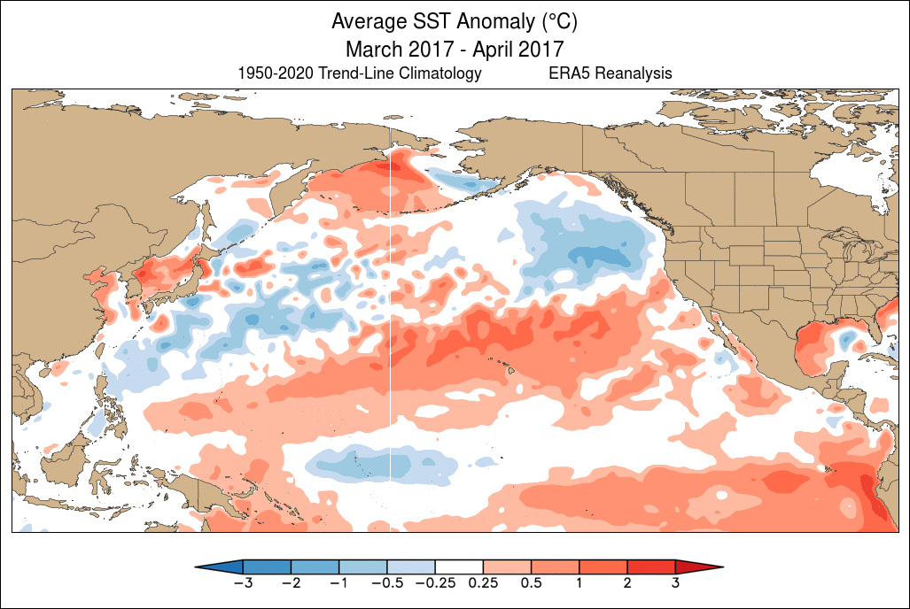
In contrast, however, I think the recurring pattern of the last 7 years is in fact linked to North Pacific SSTs, and strongly so. Check out the sequence of March-April SST maps below, starting with 2014, when the so-called "blob" of excessive warmth was very much evident in the northeastern North Pacific. This anomaly was linked to the "ridiculously resilient ridge" over western North America, leading to California drought and other things. The "blob" pattern evolved into a strongly positive PDO pattern by 2016 in response to the intense 2015-16 El Niño, but then a regime change occurred in 2017-2018 as warmth transitioned to the northwestern North Pacific:
It is remarkable to see how persistent the pattern has become since... yes, 2018. Here's a summary graphic showing the March-April detrended SST anomaly over the 7 years:
The alignment with the 500mb height anomaly is undeniable:
A really interesting aspect of this is that the warmth from Japan to the waters south of Alaska has persisted more or less unchanged regardless of El Niño and La Niña. In the sequence of SST maps above, notice the major swings in tropical Pacific SST anomalies. Normally we expect extratropical SST patterns to respond to ENSO - as in 2015/2016 - but the northwestern North Pacific seems to be marching to a different tune.
As an aside, it's worth noting that the emergence of warmth in the NW North Pacific in 2018 was quite striking at the time, and I commented on it in the North Pacific "blob blog":
Is this just the negative PDO phase that we're seeing in the North Pacific pattern? Not entirely. The PDO has indeed been persistently and significantly negative since 2021 - but not in 2018-2019.
A classical negative PDO phase tends to be linked to a trough over Alaska and cool waters from the Bering Sea and Gulf of Alaska to the northeastern Pacific, but the Bering Sea has been generally warmer than normal in recent years (especially in 2018-19), and Alaska hasn't been unusually cold. Also, a negative PDO is not linked to above-normal precipitation in Nome in early spring. The following maps show the average March-April pattern when the PDO was strongly negative over the decades.
So what can we take away from this discussion? I think we can conclude rather confidently that the early spring wet pattern in (especially) western Alaska is linked to the persistent and exceptionally unusual North Pacific warm zone stretching east from Japan that emerged in 2018. This developed in tandem with atmospheric ridging that both reinforced and was reinforced by the SST anomaly, and the atmospheric circulation anomaly has produced a storm track into western Alaska.
As for the deeper cause of the North Pacific anomaly, we can attribute some of it to the negative PDO phase (i.e. natural multiannual/decadal variability), but the excess warmth from the Bering Sea to the Gulf of Alaska is unexplained. It feels like a new angle on the multi-year northeastern Pacific warm episode that developed in winter 2013-14, although the new warm zone now has a much greater duration. I also have a sense that the new regime is related to "Arctic amplification" of the global warming trend, but this is speculation; presumably at some point the North Pacific pattern will shift again.
Finally, a question for next time: how else has the 2018 regime shift affected Alaska climate? It will be interesting to look for other climate anomalies that developed at the same time, but for other locations and at other times of year.


IMO this fisheries issue is likely related to the ocean temp anomaly:
ReplyDeletehttps://www.fisheries.noaa.gov/feature-story/noaa-fisheries-finds-endangered-species-act-listing-gulf-alaska-chinook-salmon-may-be-warranted
Thanks for the link. Occam's Razor suggests yes.
DeleteThe SST anomaly since 2018 looks consistent with negative PDO, just shifted north substantially and expanded somewhat.
ReplyDeleteYes, I agree there is a good resemblance, although a warm Bering Sea is very uncharacteristic of a negative PDO.
Delete