Here's one of many news articles:
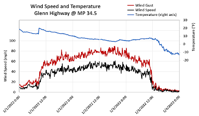
And another: the local impacts have been severe.
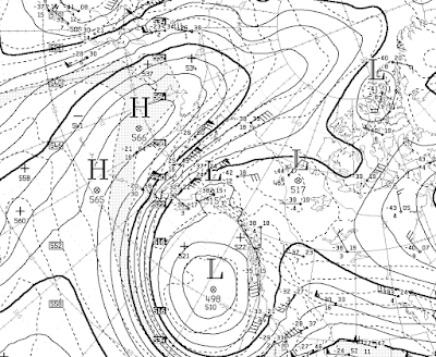
The surface analysis map from 3pm Sunday, courtesy of Environment Canada, shows the intense pressure gradient responsible for the winds: note the 1054mb high over northern Alaska and the sprawling ~980mb low in the Gulf of Alaska.

Here's the 500mb height map for the same time. Now that's an amplified flow pattern!
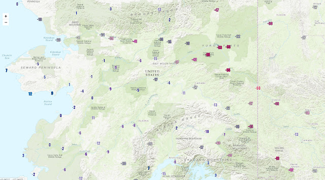
Temperatures have plummeted to extreme lows in the Yukon Flats and the far eastern interior, with Eagle so far the coldest at -59°F today (the -60°F on the map below is a rounding error). Colder still may occur in the Fortymile country and upper Tanana valley in the next couple of days.
No comments:
Post a Comment