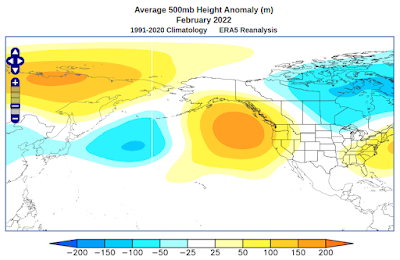
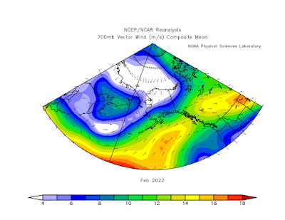
This complex setup had the effect of creating a persistent frontal zone across the southern half of the state. The trough/ridge dipole over the North Pacific brought up abundant warm air from the south, but the other ridge/trough dipole to the north generated cold northerly flow, with low-level easterlies, that locked in cold conditions over Arctic Alaska. Here's a map of wind vectors at 700mb, or about 9000 feet above sea level.
Frontal zones mean precipitation, and there was a lot of it in southern and eastern Alaska. Total precipitation for the month was near or above the highest in the past 30 years for most of the southern and eastern interior, Gulf Coast, and Southeast.
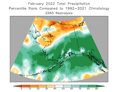
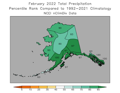
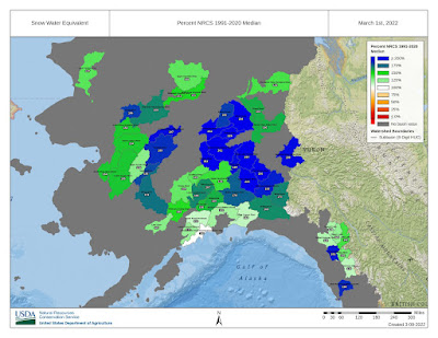
There's obviously a big disagreement between the ERA5 model data and NOAA's climate division data for the North Slope and northwestern Alaska. Given how few ground truth snow measurements are made in northern Alaska, I'd actually give more credence to the model.
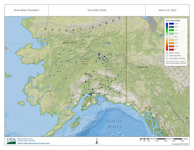
The March 1 snow survey shows record or near-record snow water equivalent across a wide expanse where measurements are made. There's clearly a much-elevated risk of flooding during breakup this year. Click to enlarge:
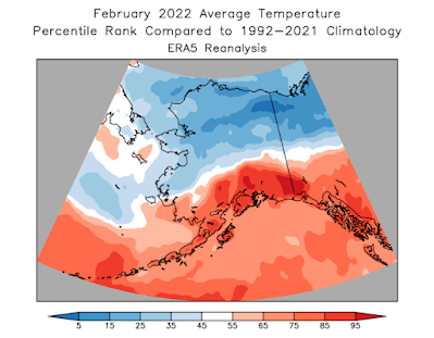
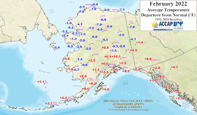
The temperature rank maps below highlight the unusual north-south contrast in the departures from the normal. As Rick Thoman pointed out, it's much more common to have a west-east gradient in the anomalies.
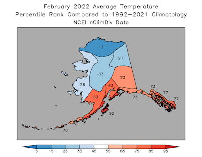
Here's Rick's station anomaly map:
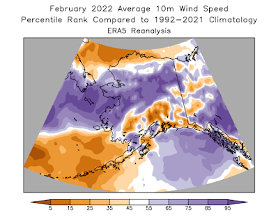
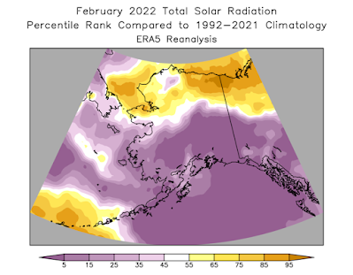
And a couple of other variables from ERA5, showing big departures from normal in many areas:
It's finally March in Fairbanks. Deep snow, clear, daily temp swings 20-40* from insolation, and brisk NE-E winds. Typical seasonal WX with a High ridge to the north and Lows to the south in the Gulf. Spring has sprung.
ReplyDeleteGary
Sounds delightful!
ReplyDeleteThis is the time of year residents that have sheltered in place all winter leave their domains and wander about acting goofy like wild hares. Lots of sun but still cold. Later, if it's still winter-like in late March or early April depression can set in. But then there's there inevitable Final Warming with water everywhere and lots of breakup boots being worn.
ReplyDeleteGary