This morning's chill was notable in the hills above Fairbanks, with widespread lows below 20°F. Down at valley level, the Goldstream Creek observer measured 18°F, and the Salcha RAWS reached 10°F, the third morning at 11°F or below in recent days. It's not particularly unusual, but the rate of the temperature decline never ceases to amaze (me) at this time of year. [Update Saturday morning: down to 7°F this morning at Salcha.)
Looking at statewide data, it's typical to see a temperature below 10°F somewhere in the state before September ends, and sub-zero is not rare. Two years ago the early cold was more severe. Usually the coldest reports at this time of year come from locations in and around the Brooks Range, such as Ivotuk, Toolik, or Chandalar Lake.
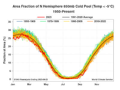
Despite the chill, there's less cold air around in the Northern Hemisphere than in previous years. Here's a chart I made today to illustrate the daily evolution of the areal extent of air below -5°C at the 850mb level (roughly 4500' above sea level):
A threshold of -5°C at 850 mb has been suggested as a good way to delineate the lower tropospheric cold pool that expands each winter and virtually disappears in summer. The figure above shows that the cold pool, so defined, typically extends across 25-30% of the hemisphere in January. This year the cold pool's growth is lagging the 1991-2020 normal significantly, and in fact this month's cold pool area is the lowest on record so far (for the month to date).
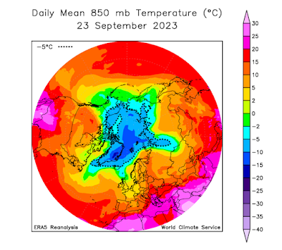
Here's a map to illustrate the cold pool's extent in the most recent day of data from ERA5:
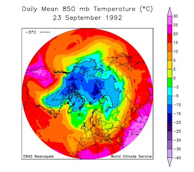
Based on data since 1950, the year with the most expansive cold pool in September was - surprise, surprise - 1992, when Alaska saw its record-setting early cold snap. Here's what the 850 mb temperature map looked like on the same date in 1992:
Clearly it wasn't just Alaska that was affected by unusual early cold in the high latitudes that year.
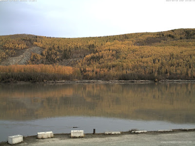
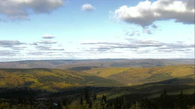
Finally, it's worth noting that despite the sharp freezes, there is still a lot of color on the trees in and around Fairbanks. I find this quite remarkable at the end of September. Nenana and Cleary Summit webcam views from the last day or so:
Here's an animation of the foliage changes at Nenana:

"Finally, it's worth noting that despite the sharp freezes, there is still a lot of color on the trees in and around Fairbanks. I find this quite remarkable at the end of September."
ReplyDeleteRemarkable but not really that unusual. Maybe it's a decadal thing. Here's a post from 2013...
http://smilesfromnowherre.blogspot.com/2013/10/autumn-leaves.html
Thanks very much, that provides helpful context. Interesting that 2013 is when the recent era of major North Pacific warmth emerged. Like you, I wish there were a historical record of fall foliage changes.
ReplyDeleteNot new news, but around the equinox surface temps either rise or fall (now it's Fall). Sitting in the last of summer's sun recently convinced me there's not much insolation left until later March 2024. Any cloud soaks it up before hitting terrain. Bye Bye sun.
ReplyDelete