Last month I penned a few comments on the big news in the weather industry: the emergence of AI models as a legitimate competitor to traditional physics-based models for weather forecasting.
To provide a more concrete example of the impressive performance of the new models, I pulled out forecasts for Fairbanks from two of the AI models that I've been running over the past couple of months. Note how remarkable this is: the models can be run on pretty modest hardware; you don't need a supercomputer.
Here's a basic comparison of forecast skill for days 1-14 of the 2m temperature forecasts for Fairbanks (click to enlarge). Here I'm using ERA5 reanalysis data as "ground truth".

The two AI models are GraphCast (Google) and FourCastNet (NVIDIA), and I'm running FourCastNet with 50 members based on the initial conditions in the ECMWF ensemble forecast. GraphCast is more computationally demanding, so I only have a single member each day. The usual (traditional) ECMWF and GEFS ensembles have 51 and 31 members respectively.
Remarkably, GraphCast's single forecast member equals the ECMWF ensemble skill out to 9 days. The ECMWF ensemble is the gold standard for medium-range forecasting, so this is a terrific result that confirms the power of the new models. In contrast, FourCastNet starts out strong but roughly equals GEFS after 5 days, with inferior skill. Note that systematic bias could affect these results to some extent, as I used the ERA5 seasonal normal as the baseline, without any bias correction.
Looking at the mid-atmosphere 500mb height forecasts, it's interesting to note that GraphCast drops off significantly after 10 days, while FourCastNet shows a very strong performance. This may be reflecting the benefit of an ensemble approach for the medium-range (7-14 day) forecast.

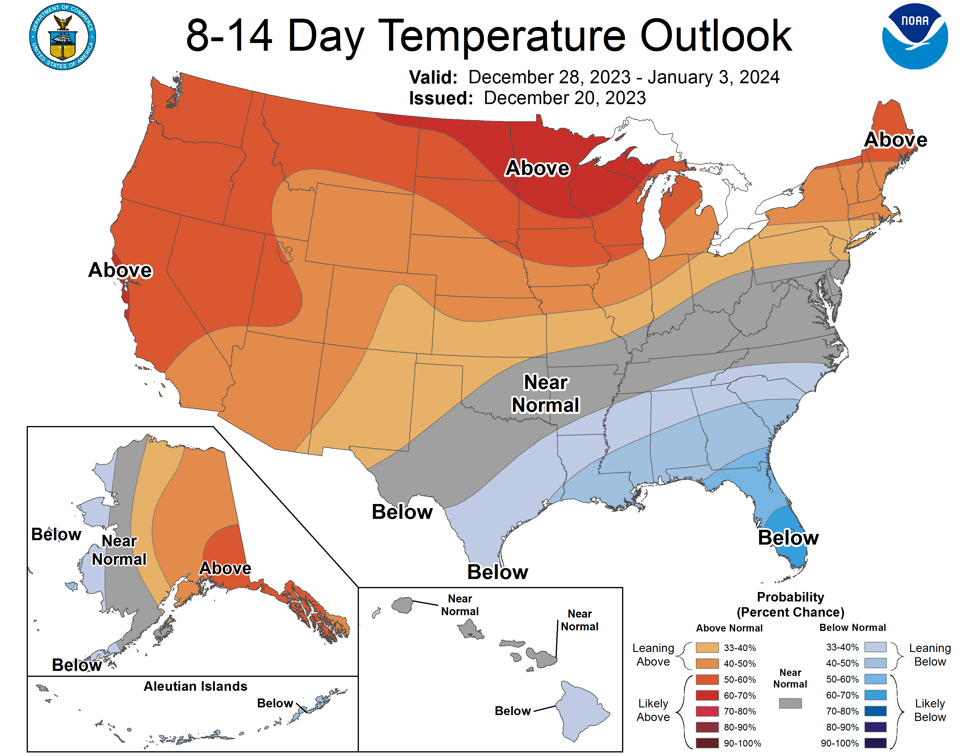
More results will be forthcoming when I have time. In the meantime, here's the latest forecast I have access to: the message is "warmer than normal" in Fairbanks, and perhaps especially around Christmas Eve and New Year's Eve.

The CPC's 8-14 day forecast also calls for warmth for central and eastern Alaska around the New Year period. It's a very typical El Niño pattern nationwide.
Thank you Richard. Always nice to see new things can work properly. Now they can refine and adjust vs what actually happened. Merry Christmas and best wishes for a New Year.
ReplyDeleteOne interesting event this winter is the repeated movement of our barometer...like an engine tachometer it cycles up and down frequently. More often I believe than usual. Lots of pressure changes from storm movements.
ReplyDeleteInteresting observation, Gary. The variability of temperatures in Fairbanks tends to be lower in El Nino winters, but MSLP variance may behave differently. Something to look into.
Deletehttps://ak-wx.blogspot.com/2017/01/colder-again.html
Merry Christmas!