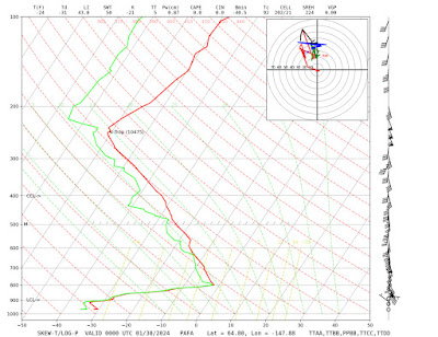
The axis of the cold trough aloft has shifted westward in the past couple of days - towards a more climatologically favorable position - and therefore southerly flow has developed across the central and eastern interior, bringing clouds, widespread light snow, and relatively warmer temperatures. This morning's 500mb analysis:
Accordingly, the core of the surface-level cold has moved to western and southwestern Alaska. One of the more notable cold spots this morning was Unalakleet on the Norton Sound coast: the temperature dropped to -45°F with a light southeasterly breeze as cold drained out of the interior. This appears to be the lowest temperature in Unalakleet since February 1999. The all-time record there (with data since 1941) is an almost unfathomable -59°F, which occurred almost exactly 35 years ago during the great 1989 cold snap. A number of interior spots dropped into the -70s in that event, making the current cold snap look paltry.
There's more cold to come later this week as an arm of the trough reloads over eastern Alaska, but so far the coldest readings I've seen are -57°F at Fort Yukon, Bettles, and the Norutak Lake RAWS; -58°F at Tanana; and -59°F at the Allakaket FAA site. (As an aside, the North Pole 1N co-op site has been reporting ridiculous numbers below -60°F and is not credible at all.)
So far I've not seen a daily high temperature of -50°F or lower. Bettles came close yesterday, with a daylight high of -50°F, but clouds rolled in before midnight, lifting the temperature by a full 20°F after dark.
Here are some of today's low temperatures (the online map is too large to fit in one screen capture):


No comments:
Post a Comment