Wednesday, October 19, 2011

1981-2010 Normals


Here's a couple of plots showing how the 1981-2010 normals that became effective August 1st have changed from the 1971-2000 normals at a number of first order stations around Alaska. Of particular note is that all the locations at least a little be wetter, and all locations are warmer. While the absolute temperature changes are largest in winter, the standardized change (the change divided by the standard deviation, not shown) is actually largest in June at nearly all the sites. This has important ramifications for both hydrology and fire weather. The big changes in precipitation at a few sites (but mostly Barrow) reflect a few really wet months in what are otherwise dry times of year, and highlight a problem with using the mean value of precipitation (and snowfall too) as "normal". In these cases the median is a much better statistic for expressing "normal".

Sunday, October 16, 2011

Fairbanks First Measurable Snow


I had not posted on this before due to conflicting data, but now this has been cleared up. The first measurable snow for Fairbanks was on Thursday, October 13th, with 0.1" of snow. This is two weeks later than the mean first measurable snow.

More "significant" snow, i.e. several tenths of an inch, fell early Sunday morning. Here is the 1030am ADT view from UAF West Ridge,from the Alaska Climate Research Center Webcam.

Saturday, October 15, 2011

2011 Temperatures


Here's a plot of temperatures thus far in 2011 at Fairbanks. I've plotted the mean daily temperature against the 1980-2010 normals and standard deviation. So, where the green line (2011 data) falls outside of the shaded area, this represents a statistically significant deviation from the expected. This way of looking at variations from normal is much more useful than the raw "departure from normal" in places with continental type climates, or high latitudes in general, where the potential variation in temperatures is much greater during the cold season than the warm season.

The very warm weather at the end of May is the most prominent feature, and to a lesser extent the cold weather in mid to late February. This autumn, the mild weather has been consistent, but not much outside of "expected" range.

Thursday, October 13, 2011

World gone White, or Not

Warm advection snow associated with the storm centered near the Bering Straits overspread central Interior Alaska Thursday morning. Here on Keystone Ridge, here's the view as of about 3pm ADT:


A little more than half an inch. Normally not much for mid October, but we'll take it.

Meanwhile, here's a view of UAF West Ridge just before 4pm ADT:


The most important reason for the difference is that there has been very little precipitation in town, with only a trace liquid at the Airport through 4pm ADT.

Wednesday, October 12, 2011

Freezing at last

With a low of 19F this morning, Fairbanks will have the first day this autumn with a mean temperature below freezing today, October 12th. This is right at the 90 percentile of the distribution. That is, only 10 percent of years 1930-2011 have the first day with a mean temperature below freezing on October 12 or later. At this point it looks like except for a brief chinook Friday/Saturday, the freezing season is upon us. No if we could just get some snow…

Monday, October 10, 2011

Brooks Range Snow Drought


It isn't just Fairbanks-land that's suffering from a dearth of snow. Here's a lovely morning photo (courtesy of the FAA) from Arctic Village in the eastern Brooks Range. Frosty, but snowfree, at valley elevation (about 2000' MSL). There are no long term stats for this part of the world, but my sense is that it very unusual to go into mid-October without a snow cover at Arctic Village.

Saturday, October 8, 2011

Active Sky at Northway


A tight low aloft produced a small area of snow showers in the far southeast Interior on Saturday. Here is a dramatic looking photo from the FAA webcam at Northway about 1230pm ADT Saturday.

Still No Snow for Fairbanks

Snow is getting closer to Fairbanks. There was a report of eight inches of snow at Summit Lake (on the Richardson Highway), elevation 3200' MSL, Friday night and early Saturday, and some places above 2000' MSL around Fairbanks had a skiff of snow in a brief shower Friday evening. Still, the greater Fairbanks metro area has yet to have measurable snow. We are now past the 75th percentile of dates with measurable snow, i.e. more three-quarters of the time Fairbanks has received measurable snow by this point in the calendar. Here is a histogram showing how the dates are distributed:


The lack of snow is not (just) because it's been too warm. There has been hardly any precipitation recently. Since September 17th the Airport has received just 0.04 inches of precipitation, and none measurable in the past two weeks.

The current forecast is for very little chance of any snow (or rain) in Fairbanks at least through Tuesday and probably beyond that.

Wednesday, October 5, 2011

Winter Encroaches


Alessio Gusmeroli, PhD, Postdoctoral Fellow at the UAF Geophyscial Institute took this photo on Sunday, October 2nd near Twelve Mile Summit on the Steese Highway. Elevation roughly 3000' MSL.

Coldest of the Season so Far

Clear skies overnight allowed valley temperatures to fall to the lowest levels of the autumn thus far. Lows included:

Goldstream Creek: 15F
Woodsmoke PWS: 16F (near North Pole)
Eileson AFB: 18F
Gilmore Creek: 20F near Fox
Fairbanks Airport: 23F
UAF West Ridge: 23F

In the hills this was not the coolest night so far: lows were at or just slightly below freezing. Here on Keystone Ridge, the low was 30F but the heavy frost sure was pretty.

Tuesday, October 4, 2011

More on First Freezing Day

I'm a big believer in the maxim "statistics don't lie, only people do". Okay, I've never actually heard anyone but me say that, but still…

So, here are the statistics on when in the autumn Fairbanks has its first day with the daily mean temperature below freezing. It turns out that the average date in the WB/NWS era (1930-2010) is October 3rd. The time series shows a weak but statistically insignificant trend toward later dates:


When we put the dates into a histogram, we see that presently (Oct 04) we're right in the peak of the distribution:


If Fairbanks were to go through the weekend without a day with a mean temperature below freezing, that would be beyond the 75th percentile and into the realm of "unusually late".

New Barrow Webcam


The long awaited FAA webcam at Barrow is now online. This does not have a coastline view like the UAF Sea Ice program does, but should be more reliable. Here's the view looking east across the runway noon Tuesday.

No Freezing Degree Days

Here on Keystone, through Monday, October 3rd, there has been no freezing degree days (FDD) yet, which makes this the latest in the autumn we've gone with zero FDD. What is a freezing degree day? It's the sum of 32F minus the daily mean temperature. Like most degree day statistics, there are no negative values: if the mean temperature is above freezing, the FDD is zero.

However, there are only 16 years of obs here on the hill, and two years, 2001 and 2006, had only 1 FDD through Oct 3rd.

If we look at the Fairbanks data for FDD, it turns out that it is by no means unusual to go this late in the autumn without any FDD yet. In 2009, 1979 and 1943, there were no FDD until October 18th, and the record warm October 1938 had no FDD until the 27th.

This is not quite an apples to apples comparison; I'd expect Keystone Ridge to have earlier occurrence of FDD, but it's probably safe to say that the lack of freeze not yet terribly unusual. The current numerical guidance suggests though that it will be at least the weekend and probably longer, so the lack of freeze may become extreme.

Sunday, October 2, 2011

5th Warmest September of record at Barrow

Last month was the 5th warmest September of record at Barrow. Here are the rankings, temperatures in degrees F.

1. 37.7 (1998)
2. 37.6 (2007)
3. 37.4 (2010)
4. 36.8 (1986)
5. 36.7 (2011)

Weather observations start in Oct 1921 in Barrow, so this is based on 90 years of data.

Saturday, October 1, 2011

September Summary

The Fairbanks-land weather summary for September…

PUBLIC INFORMATION STATEMENT
NATIONAL WEATHER SERVICE FAIRBANKS AK
1142 AM AKDT SAT OCT 1 2011

...SEPTEMBER 2011 IN FAIRBANKS...

...DRY AND MILD...

SEPTEMBER WAS A PLEASANT AUTUMN MONTH WITH PERSISTENTLY ABOVE
NORMAL TEMPERATURES AND MOSTLY DRY DAYS.

ONLY THREE DAYS DURING THE MONTH HAD AN AVERAGE DAILY TEMPERATURE
EVEN SLIGHTLY BELOW NORMAL...WHILE AN EQUAL NUMBER OF DAYS HAD AN
AVERAGE DAILY TEMPERATURE MORE THAN 10 DEGREES ABOVE NORMAL.

OVERALL...THE AVERAGE HIGH IN SEPTEMBER AT THE FAIRBANKS
INTERNATIONAL AIRPORT WAS 59 DEGREES AND THE AVERAGE LOW WAS
39 DEGREES. THE AVERAGE TEMPERATURE FOR THE MONTH OF 49.0 DEGREES
MADE THIS THE 10TH WARMEST SEPTEMBER IN MORE THAN A CENTURY OF
WEATHER OBSERVATIONS IN FAIRBANKS. THIS IS THE 7TH CONSECUTIVE
SEPTEMBER TO BE SIGNIFICANTLY WARMER THAN NORMAL...AND FOUR OF THE
TEN WARMEST SEPTEMBERS OF RECORD HAVE OCCURRED IN THE PAST 20
YEARS.

THE HIGH TEMPERATURE AT THE AIRPORT FOR SEPTEMBER WAS 72 DEGREES ON
THE 5TH AND 13TH...WHILE THE LOW OF 28 DEGREES OCCURRED LATE IN
THE EVENING ON THE 30TH. THE FIRST FREEZE OF THE AUTUMN AT THE
AIRPORT OCCURRED ON THE 25TH...WHICH TIED WITH 2006 FOR THE SECOND
LATEST FIRST FREEZE OF RECORD. AMAZINGLY...ALTHOUGH THE LONG-TERM
AVERAGE DATE FOR THE FIRST FREEZE AT THE AIRPORT IS SEPTEMBER
7TH...THIS IS THE SIXTH CONSECUTIVE YEAR IT HAS BEEN AFTER
SEPTEMBER 20TH.

EVEN IN TYPICALLY COLDER LOW LYING AREAS...TEMPERATURES IN
SEPTEMBER FAILED TO DROP BELOW THE 20S...WITH MONTHLY LOWS OF
20 DEGREES AT GOLDSTREAM VALLEY BOTTOM AND 23 DEGREES AT WOODSMOKE
NEAR NORTH POLE.

PRECIPITATION WAS SIGNIFICANTLY BELOW NORMAL. THE TOTAL FOR THE
MONTH OF 0.65 INCHES AT THE AIRPORT IS ABOUT 60 PERCENT OF NORMAL.
MEASURABLE RAIN FELL ON JUST NINE DAYS...AND ABOUT TWO- THIRD OF
THE MONTHLY TOTAL FELL ON THE 9TH AND 10TH. THE FIRST SNOW
FLURRIES OF THE SEASON FELL ON THE LAST DAY OF THE MONTH OVER MUCH
OF THE AREA. AT THE AIRPORT THIS IS ABOUT A WEEK LATER THAN NORMAL
FOR THE FIRST SNOW.

AUTUMN COLORS SEEMED UNUSUALLY LONG LIVED IN SEPTEMBER...AND ONLY
AFTER THE EQUINOX WERE TREES LARGELY BARE. THE MONTH ALSO FEATURED
SEVERAL NIGHTS WITH ACTIVE NORTHERN LIGHTS.

LOOKING AHEAD TO OCTOBER...THE WINTER SNOW PACK IS NEARLY ALWAYS
ESTABLISHED SOMETIME DURING THE MONTH...AND THIS HELPS
TEMPERATURES TO FALL DRAMATICALLY. THE AVERAGE HIGH TEMPERATURE
DROPS FROM 45 ON THE 1ST TO 19 ON HALLOWEEN...WHILE THE AVERAGE LOW
TEMPERATURE FALLS FROM 28 DEGREES ON THE FIRST TO 4 ABOVE ON THE
31ST. TOTAL PRECIPITATION AVERAGES 0.83 INCHES AND AVERAGE
SNOWFALL 10.8 INCHES. SIGNIFICANT AMOUNTS OF RAIN ARE UNCOMMON IN
FAIRBANKS AFTER THE FIRST WEEK OF THE MONTH. THE PERMANENT
WINTER SNOW COVER IS ESTABLISHED...ON AVERAGE...ON OCTOBER 18TH.
POSSIBLE SUNSHINE DECREASES FROM OVER 11 HOURS DURING THE FIRST
THREE DAYS OF THE MONTH TO LESS THAN EIGHT HOURS ON THE 31ST. THE
FORECAST FOR THIS OCTOBER FROM NOAA'S CLIMATE PREDICTION CENTER
CALLS FOR SLIGHTLY INCREASED CHANCES OF SIGNIFICANTLY BELOW NORMAL
TEMPERATURES.

$$
RT OCT 2011

Saturday Morning at Home


The snow came in a shower just before dark Friday evening. All melted by Saturday mid-afternoon.

Brooks Range Snow


October dawns white in the Brooks Range: Saturday morning photo from the FAA webcam at Chandalar DOT camp at Mile 239 on the Dalton Highway.

Thursday, September 29, 2011

Autumn Creep


From the train station at Denali National Park 755AM Thursday

Tuesday, September 27, 2011

Cooling Down up North


Here's the 4pm AST Tuesday (00 UTC Wednesday) surface analysis from Environment Canada. We're finally starting to see some subzero temperatures in far northwest Canada, with a low temperature of -5F this afternoon at Isachsen, NU (78N, 104W). Nowhere else in the northwest Canadian Arctic has been quite that cold thus far, but with a decent snow cover now and open water freeing up, it will not be long.

Sunday, September 25, 2011

First Freeze

Most valley locations that had yet to have a freeze finally got one this morning. The low temperature of 32F at Fairbanks International Airport ties for the second latest first freeze of record. The low of 30F at UAF West Ridge is the third latest of record (since 1949). Here on Keystone Ridge, close, but no cigar, so far. Low was 34F, with some frozen rain on the car. However, the first freeze here has been later than September 25th three times since 1996.

Saturday, September 24, 2011

Barrow Finally Below Freezing

Late on Friday evening, September 23, Barrow dipped below freezing for the first time since June 29th. The streak of 85 days is 17 days longer than the previous record set in 2009.

Friday, September 23, 2011

Blast Furnace from the Past

With temperatures headed back toward something like normal over Interior Alaska this upcoming weekend, this seems a good time to look back at one of the greatest autumn chinooks of record.

It was mid-September back in '95, when sustained strong southerly flow brought six straight days with highs of 70F or higher to Fairbanks. Here is the NCAR reanalysis for 4am ADT Sep 20th:


Remarkable in itself, but this was topped off by one of the most anomalous temperature records in the 100+ years of weather observations here. On September 20th, a very mild airmass and strong southeast winds that remained up all kept the daily low temperature to an unbelievable 65F. Here's a plot of the upper air observations from Fairbanks for 4am ADT Sep 20th, courtesy of the Plymouth State Weather Center. Note that the near surface is well mixed thanks to the winds:


The low of 65F is not only, by far, the highest daily minimum temperature of record in September, its higher than any daily min temperature in August. This is a stunning 4.6 standard deviations above the long term mean daily minimum temperature for the three days centered on September 20th. This "standardized departure" is the largest daily positive anomaly in the Weather Bureau/NWS era of observations (1930-present) in Fairbanks.

Wednesday, September 21, 2011

Barrow no-freeze

Amazingly, Barrow STILL has not been below freezing. The low Tuesday Sep 20th was 32F, and there was 0.3 inches of snow in the early morning. The streak of temperatures at or above 32F now stands at 83 days. Wow.

Monday, September 19, 2011

The Beat Goes on

Overnight low temperatures:

Fairbanks International Airport: 35F
UAF West Ridge: 33F

Barrow: 34F

Monday morning guidance (technically, MOS) actually does not have Fairbanks IA with a low of freezing or below for the next week, though two days have a low of 33F. Far be it from me to put much faith in this, but clearly this could go on for some time to come: since it almost certainly will not get to freezing in the next few days, this will be one of the latest of record, and continuing the now six year long streak of very late first freezes. The latest "first freezes" at Fairbanks IA are:

1. Sep 27 1974
2. Sep 25 2006
3. Sep 23 2009
Sep 23 1982
4. Sep 22 2010
Sep 22 1978
Sep 22 1973
5. Sep 21 2008
Sep 21 2007

Sunday, September 18, 2011

More on No freeze

Continuing on the topic of first autumn freezes, here's a plot of the date of first freeze at Fairbanks Airport.


Obviously, the date of first freeze has not been consistently so late in September anytime in the past 60 years. Also note the increased frequency of very late dates since 1997. Suspiciously, this corresponds to the advent of the switch to the ASOS. However, this can only be (at most) part of the story, as this plot of the date of the first freeze at the College 5NW co-op site shows:


College 5NW is the longest climate time series we have for the Fairbanks area hills: it is about 450' MSL above Goldstream Creek. This is not quite an apples to apples comparison: in a few years the date of first freeze at the airport is from the temperature dropping to or below freezing in the late evening, while College 5NW has had an observation time around 8am for most of the period of record. Still, while College 5NW has sometimes had late dates through its period of record, the consistently late dates since 2006 again stand out as unprecedented.

Saturday, September 17, 2011

Still no Freeze


It's a lovely morning for the Equinox Marathon, with temperatures around 40F for the start of the race. Runners have had to slog through snow on Ester Dome in some years, but not this one.

Between 1952 and 2005 the first freeze of the autumn at the Fairbanks Airport was September 20th or later five times (in 54 years). Since 2005, the first freeze has been September 20th or later EVERY autumn. The low temperature so far has been 36F, and both the overall pattern and numerical guidance suggests this year will continue that strong trend.

It's not just the airport either, as Fairbanks Midtown, University Experiment Station and UAF West Ridge Co-op sites have all yet to see a freeze, and none of the hill sites have been close to freezing. The cooler valley spots have of course, although the low of the season thus far at KJNP in North Pole (the oldest of the Co-op sites in the North Pole area) is just 29F.

Thursday, September 15, 2011

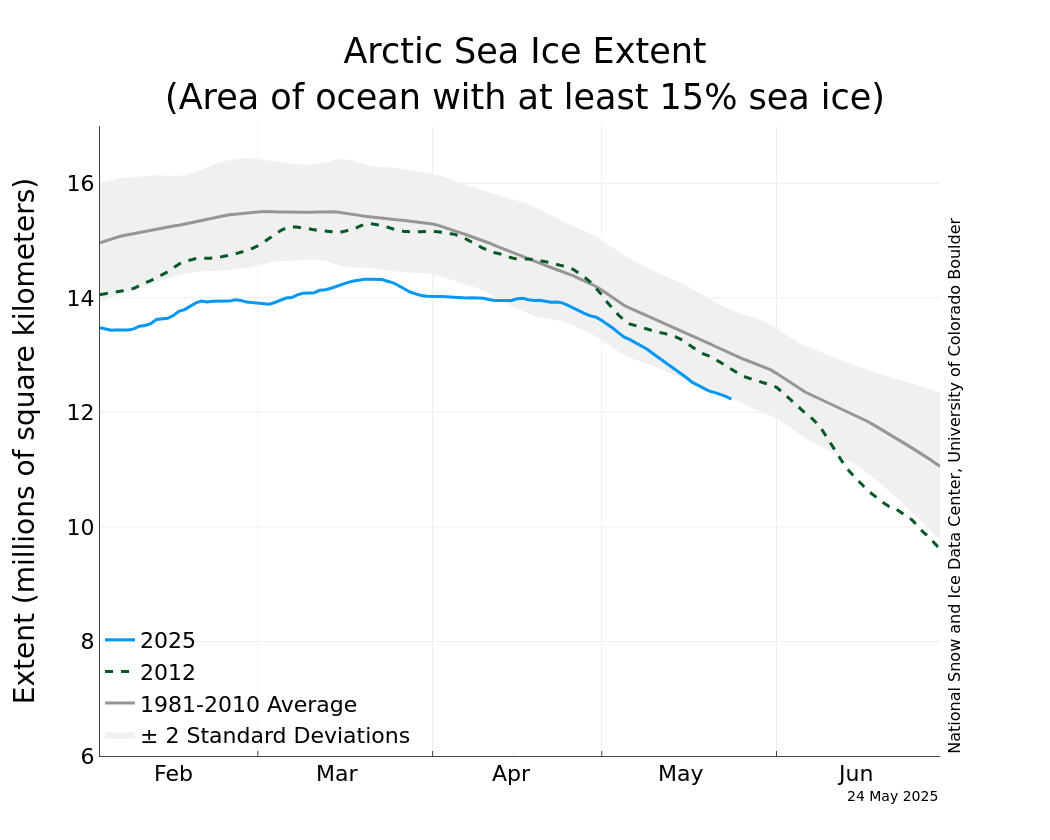
Summer Arctic Sea Ice Minimum

It looks like the minimum Arctic Sea Ice coverage has been reached. The National Snow and Ice Data Center reports a coverage of 4.33 million square kilometers on September 9th, with coverage having increased slightly since then. Here is the Alaska-centric view from September 14th from the University of Illinois Polar research group. Notice how far beyond the coast the ice edge is:


If this is the minimum (and there is some chance that the coverage could yet decrease), this would be the second lowest of the satellite era and four percent above the minimum coverage of 2007. Here is the comparison from NSIDC:


The University of Bremen made the news earlier this week with the report that sea ice coverage was lower than 2007. NSIDC and Bremen use different procedures and datasets (the Bremen data has higher horizontal resolution than NSIDC). However, the main point is not whether 2011 was just above or just below 2007. The message is that summer and autumn sea ice coverage continues to rapidly decline and that 2007 was not some "fluke", the result of some rare combination of weather.

Monday, September 12, 2011

Pretty Evening


A pretty Monday evening at Chandalar DOT at Mile 239 Dalton Highway. Snow level is about 3500' MSL. Photo from the FAA.

What no sea ice means


PUBLIC INFORMATION STATEMENT
NATIONAL WEATHER SERVICE FAIRBANKS AK
240 PM AKDT MON SEP 12 2011

THE TEMPERATURE AT BARROW...THE NORTHERNMOST CITY IN ALASKA...
HAS NOT BEEN BELOW FREEZING...32 DEGREES...SINCE JUNE 29TH. THIS
74 DAY STREAK IS BY FAR THE MOST CONSECUTIVE DAYS THAT BARROW HAS
EVER HAD WITHOUT THE TEMPERATURE DROPPING BELOW FREEZING. THE
PREVIOUS RECORD OF 68 DAYS WAS SET TWO YEARS AGO.

THE TEMPERATURE IS NOT EXPECTED TO GO BELOW FREEZING AT BARROW FOR
AT LEAST A FEW MORE DAYS.

$$
RT SEP 11

This is a direct result of the pack ice being 150 miles north of Barrow and nearshore water temperatures in the 40s.

Saturday, September 10, 2011

Autumn


A cloudy Saturday over most of northern Alaska.; polar orbiter image from NWS Alaska Region. Here in Fairbanks-land, rain and temperatures in the 30s and 40s. Snow level is above most of the terrain: at 3pm ADT temperature was 35F at both Munson Ridge (3100' MSL) and Caribou Peak (2500' MSL), 39F here at Keystone Ridge (1600' MSL). Rainfall amounts so far mostly in the tenth to quarter inch range. Combined with the golden foliage, it really seems like autumn, though warmer weather is on tap for early next week.

Thursday, September 8, 2011

No urban heat island here


Here is the plot of temperatures for the past year at Eureka, Nunavat, from the Climate Prediction Center. Eureka is on the Fosheim Peninsula, on the north-central side of Ellesmere Island at 80N. Unlike other northern Canadian weather stations in the high Arctic, Eurerka is set back on a deep fjord, so has a less maritime climate that other sites. The middle plot shows the 30-day running mean, which smooths out the day to day variation in "weather", though as the top plot shows, temperatures have been monolithically above normal since early May.

Wednesday, September 7, 2011

Arctic Sea Ice Seond Lowest of Record

The National Snow and Ice Data Center has released their August analysis of sea ice cover in the Arctic. The mean ice coverage for the month of 5.52 million sq km is the second lowest of the satellite era (since 1979). There is the plot of NSIDC of the August mean coverage: the trend is stunning.


The press release also notes that as of September 5th the coverage had fallen below the minimums measured in both 2008 and last year, guaranteeing that 2011 is at least the second lowest minimum coverage of record. Here is the coverage plot for September 6th from the University of Illinois Polar Research group.


The ice melt season has about two weeks to go, and is certain to be very close to the 2007 record minimum. The implications for Alaska weather and climate are, of course, large. The fact that Barrow has not had a temperature of freezing or below since July 9th is directly attributable to the lack of near shore sea ice and the "warm" waters offshore (as of Seep 6th the NWS Anchorage Marine Ice program had sea surface temperatures of about +6C near Barrow).

Monday, September 5, 2011

Here comes ex-Talas


Here's the surface analysis for 10am ADT Monday from the Ocean Prediction Center. The 956 mb low southeast of Kodiak Island is the remains of tropical storm Talas, and is making for a pretty windy wet day on the Gulf coast. Kodiak has had gusts to around 50 mph and Middleton Island about 65 mph.

Update: As of 5pm ADT, Middleton Island has had winds 63 gusting to 78 mph. The Cape Cleare buoy (46076), a little southwest of Middleton Island has reported similar winds with seas of 26 ft.

Update 2: My old colleague Stu Ostro, who works as a Senior Meteorologist at the Weather Channel, pointed out to me that this storm is not really the remains of Talas, though some of energy may be from Talas. I hang my head. Still though, a deep storm for Labor Day.

Chilly Morning


Autumn is in full swing across Interior Alaska. Here's a photo from Livengood Monday morning (from the FAA) showing the golds of September.

It was completely clear Sunday night/Monday morning, with an aurora through in for good measure. Throw in a seasonable airmass and not much wind, and it's no surprise that Monday was the coolest morning thus far this early autumn, with a fairly widespread frost or freeze in the valley.

Lows reported thus far include:

Goldstream Creek: 25F
Chena Hot Springs: 28F
Woodsmoke PW: 28F
Eielson AFB: 31F
UAF West Ridge: 35F
Fairbanks Airport: 37F
Keystone Ridge: 41F

In the hills this was not the coolest night of the season; here on Keystone Ridge it was the coolest night in almost a month.

Saturday, September 3, 2011

Talas Coming to Alaska


Tropical Storm Talas made landfall on southern Japan early Saturday and will move over the Sea of Japan later today. From there the storm will head north and then northeast, and will be a deep storm in the northern Gulf of Alaska by Monday evening. At the right is the 12UTC GFS forecast for 10pm ADT: a 958mb low in the Gulf of Alaska this time of year is quite unusual, but this is a way to do it. The storm will bring plenty of rain and wind to the coast. Here in the Interior, the main impacts will be to produce some wind and keep it reasonably mild. A bigger impact comes with the eventual evolution of the cyclone: ex-tropical systems historically give numerical models fits, especially in the mid range. So will this storm pump-up a ridge over western North America, or spin down in isolation over the Gulf? Time will tell.

Friday, September 2, 2011

Arctic Sea Ice update


Looks like the September 1st total Arctic sea ice coverage is now right at the coverage at this date during the record low 2007 season. Amazingly disturbing but utterly unsurprising. Image from the National Snow and Ice Data Center.

End of Summer


With the foliage now rapidly turning to autumnal reds and yellows, thoughts turn to the end of summer in Interior Alaska, and the question arises, are summers ending later than in years gone by? Of course, I have a chart for this question.

Since a couple of cool days does not autumn make, I've defined the end of summer as the last day in the season when the 7-day centered running mean is 55F or higher. From the plot at the left, it is clear that at least until very recently, there was no trend at all. However, the gray line is the 4 year running mean, and it has, just in the past few years, popped up to the highest value in the century of instrumental records. Through September 1, this summer is already beyond the mean date for the past 40 years, and if the forecast for the next few days works out, this will push this year's "end of summer" later still.

It is very tempting to pin this recent and dramatic change on the loss of sea ice near Alaska, though we need some modeling of this idea.

Thursday, September 1, 2011

August Weather Summary

What I did on my vacation…

PUBLIC INFORMATION STATEMENT
NATIONAL WEATHER SERVICE FAIRBANKS AK
1216 PM AKDT THU SEP 1 2011

...MONTHLY WEATHER SUMMARY FOR FAIRBANKS ALASKA...

...FAIRBANKS WEATHER SUMMARY FOR AUGUST AND A REVIEW OF THE SUMMER...

AUGUST WAS A FAIRLY CLOUDY MONTH WITH FREQUENT BUT MOSTLY LIGHT
RAINFALL. THE MONTH ENDED ON A DRIER NOTE THROUGH...WITH A STRING OF
RATHER SUNNY DAYS HIGHLIGHTING THE BEGINNINGS OF THE AUTUMN
COLORS AND A COUPLE OF LATE NIGHT AURORA DISPLAYS.

AT THE FAIRBANKS INTERNATIONAL AIRPORT...THE AVERAGE HIGH
TEMPERATURE IN AUGUST WAS 67 DEGREES AND THE AVERAGE LOW WAS 48
DEGREES. THE MEAN TEMPERATURE OF 57.2 DEGREES WAS 1.1 DEGREES
ABOVE NORMAL. THE HIGH FOR THE MONTH WAS 76 DEGREES ON THE 4TH AND
THE LOW WAS 40 DEGREES ON THE 8TH. THE COOLEST OF THE NORMALLY
COOLER OUTLYING AREA DID HAVE ONE OR MORE MORNINGS WITH FREEZING
TEMPERATURES...INCLUDING 27 DEGREES AT GOLDSTREAM VALLEY BOTTOM ON
THE 30TH AND 31 DEGREES AT WOODSMOKE...NEAR NORTH POLE ON THE
29TH.

TOTAL RAINFALL IN AUGUST AT THE AIRPORT WAS 1.60 INCHES...WHICH
WAS 0.28 INCHES BELOW NORMAL. SOME RAIN FELL ON 22 DAYS AT THE
AIRPORT...FOUR MORE THAN AVERAGE...BUT ON ALMOST HALF OF THOSE
DAYS THERE WAS JUST A TRACE OF RAIN. THE 12 DAYS WITH MEASURABLE
RAIN IS ONE DAY LESS THAN AVERAGE. THERE WERE THUNDERSTORMS IN THE
AREA ON SEVERAL DAYS DURING THE MONTH...THOUGH NONE WAS HEARD AT
THE AIRPORT. AS IS OFTEN THE CASE...RAINFALL WAS SIGNIFICANTLY
HIGHER AT NEARLY ALL OTHER WEATHER OBSERVING LOCATIONS IN THE
GREATER FAIRBANKS AREA. THESE INCLUDE...

AURORA.................1.96 INCHES...0.17 INCHES BELOW NORMAL
EIELSON AFB............2.04 INCHES...0.31 INCHES BELOW NORMAL
UAF WEST RIDGE.........2.18 INCHES...0.10 INCHES ABOVE NORMAL
NORTH POLE.............2.19 INCHES...0.17 INCHES ABOVE NORMAL
FORT WAINWRIGHT........2.35 INCHES
EAST FARMERS LOOP......2.43 INCHES
FAIRBANKS MIDTOWN......2.74 INCHES...0.62 INCHES ABOVE NORMAL
KEYSTONE RIDGE.........2.76 INCHES...0.36 INCHES ABOVE NORMAL

SMOKE FROM THE BONNIFIELD FIRE ON THE FLATS SOUTH OF FAIRBANKS WAS
EVIDENT ON SEVERAL DAYS EARLY IN THE MONTH.

FOR THE SUMMER AS A WHOLE...THE AVERAGE TEMPERATURE OF 59.8 DEGREES
AND TOTAL RAINFALL OF 5.07 INCHES ARE BOTH CLOSE TO NORMAL.
HOWEVER...EXCEPT FOR THE LAST WEEK OF MAY...THERE WAS A DISTINCT
LACK OF HOT WEATHER. THE TEMPERATURE REACHED 80 DEGREES OR HIGHER
NINE DAYS...BUT FIVE OF THOSE DAYS WERE IN MAY. THE HIGHEST
TEMPERATURE THIS SUMMER AT THE AIRPORT WAS 88 DEGREES ON JUNE
25TH. ACCORDING TO THE ALASKA FIRE SERVICE...JUST OVER 292
THOUSAND ACRES BURNED IN THE STATE THROUGH THE END OF
AUGUST...WELL BELOW THE AVERAGE OF RECENT DECADES. TWO FIRES
THOUGH THAT STARTED DURING THE WARM WEATHER OF MAY WERE OF MAJOR
CONCERN TO THE FAIRBANKS AREA....THE MOOSE MOUNTAIN FIRE ABOVE
GOLDSTREAM VALLEY AND THE HASTINGS FIRE NORTHEAST OF MURPHY DOME.

LOOKING AHEAD TO SEPTEMBER...THIS MONTH TYPICALLY FEATURES MILD
TEMPERATURES AND BRIGHT AUTUMN COLORS EARLY ON FOLLOWED BY A TASTE
OF THE WINTER TO COME BY THE LAST DAYS OF THE MONTH. THE AVERAGE
HIGH TEMPERATURE DROPS FROM 62 DEGREES ON THE FIRST TO 46 DEGREES
ON THE 30TH. THE AVERAGE LOW TEMPERATURE DROPS BELOW FREEZING ON
THE 25TH. IN THE LAST 106 YEARS...TEMPERATURES IN FAIRBANKS HAVE
RANGED FROM A HIGH OF 84 DEGREES IN 1957 TO A LOW OF 3 ABOVE IN
1992. PRECIPITATION AVERAGES 1.10 INCHES. MOST...BUT NOT
ALL...SEPTEMBERS SEE THE FIRST SNOW OF THE UPCOMING WINTER...AND A
SMALL ACCUMULATION IS NOT UNUSUAL DURING THE LAST WEEK OF THE
MONTH. TOTAL SEPTEMBER SNOWFALL HAS EXCEEDED SIX INCHES JUST FOUR
TIMES IN THE PAST CENTURY...BUT THREE OF THOSE YEARS WERE IN THE
1990S.

$$
RT SEP 11

Wednesday, August 31, 2011

Late summer sunshine


A lovely last day of August at Arctic Village, from the FAA webcam

Sunday, August 28, 2011

Return of the Inversion


I was outside at 1230am Sunday and the sky was filled with stars; just a band band of light on the northern horizon (one of the many benefits of outdoor plumbing). Weather-wise, this can only mean one thing: the return of the inversion.
On the left is the temperature plot from the 3AM upper air sounding from Fairbanks, showing a 6.4ºC temperature increase in the lowest 300 meters. The spread in morning low temperatures is of course wider. Lows include: 26ºF at the Salcha River RAWS, 29ºF at the Angel Creek RAWS. 30ºF at Goldstream Creek Co-op, 32F at the Woodsmoke (near North Pole) PWS, up to lows of 50ºF at Clearly Summit and the Nenana Hills RWISs and 48ºF here on Keystone Ridge, making it one of the mildest overnight lows of the month.

Saturday, August 27, 2011

Sea Ice Updated


All eyes are on Hurricane Irene now, but here's a quick update on Arctic sea ice coverage, from the folks at the National Snow and Ice Data Center, and as usual, the news isn't good. As of August 25th, total sea ice coverage is just barely above the record low year of 2007. What's interesting about this is that the atmospheric conditions this summer have not been a repeat of 2007. There have been times that it has been similar, but others when it has not been. This shows the impact of the now much thinner ice than was in place in 2007.

Tuesday, August 23, 2011

Late Season Thunder


There were about 170 lightning strikes in Interior Alaska on Monday, which is a lot for this late in the season. In fact, some of the cells were producing lightning til well after midnight. Here's the view from west ridge of UAF looking southeast about 910pm Monday.

Monday, August 22, 2011

Pot of Gold Found


A 9pm ADT Monday from the FAA webcam at the Ruby airport. Ruby is along the Yukon River about 25 miles upriver from Galena.

It's a Soaker


Fairbanks-land enjoyed a classic August weekend, with something like 3/4 of an inch of rain spread over Saturday and Sunday. The rain was over a long enough duration that it will not impact rivers much. Here's the hydrograph for the upper Chena River (near Mile 40 Chena Hor Springs Road) from the Alaska-Pacific RFC.

There was enough rain to bring monthly totals up to about normal. However, the number of days with rain since late July is above normal, hence the widespread perception that it has been unusually wet.

Saturday, August 20, 2011

Close but no Cigar


The mean Sea Level Pressure at Fairbanks bottomed out at 982.1mb at noon ADT Saturday, 1.2mb above the record low pressure for August.

Friday, August 19, 2011

Deep Storm in the Gulf of Alaska


A fairly deep storm for August is churning through the northern Gulf of Alaska. The 330pm ADT GOES infrared image shows a classic cloud structure to the system, with well defined warm, cold and occluded fronts. Unlike most Gulf storms, this one is forecast by all the numerical models to maintain fairly deep pressures as it crosses the Alaska Range on Saturday. In fact, Fairbanks will approach its lowest August sea-level pressure of record on Saturday of 980.9 mb (28.97 inches) set August 5, 1984.


Thursday, August 18, 2011

Fire Weather Season About Over

Damp, if not soaking weather persists over most of Alaska, and more than 200 lightning strikes Wednesday not withstanding, the fire season is about over.

According to the Alaska Fire Service, thus far a total of 292,440 acres has burned in Alaska this summer. This number has not changed (or at least been updated by AFS) for more than a week. This is about 27% of the acreage burned last summer. While not the lowest in recent years, it is well below the 20 year median of 681,000 acres.

Like last year, this year was a classic example of how the fire season in Alaska is so completely dependent on warm AND dry weather. Much of Interior Alaska was not especially wet this summer, but after mid-June there was no period of more than a couple days of dry AND warm weather. Here is a plot of the mean July 500 mb height anomalies:


Over land, lower 500mb heights in the summer correspond pretty well with cooler than normal temperatures. This is just what we see over Alaska. A big negative anomaly near the Bering Strait, but with below normal heights extending eastward.

Now here's the same plot for July 2009, which was one of the warmest and driest Julys of record over Interior Alaska, and a big fire year:


A much different picture over Alaska.

Wednesday, August 17, 2011

Signs of Autumn


Signs of autumn are starting to show in the vegetation. Here's a photo of the front yard Tuesday afternoon. The dogwood has gone purple and the Spiraea is turning yellow and red. Not much color in the birch and aspen yet but it will not be long.

Oh yeah, yesterday was the first day since July 23rd with zero precipitation here at Keystone Ridge. The 23 days is the longest streak of consecutive days with some precipitation in 15+ years of record here. However, total rainfall during this time was only slightly above normal. A lot of days with trace, 0.01 or 0.02 inches of rain. Output from the solar panels though is way down from the past few years.

Tuesday, August 16, 2011

Arctic Ice Update


Here's the Alaska-centric view of sea ice coverage in the Arctic as of August 15th. As as been the case for a couple weeks, this summer's coverage is just above the record low year of 2007. There is about another month of retreat left; it looks certain that this year will have either the lowest or second lowest summer ice minimum coverage in the satellite era (since 1979).

Sunday, August 14, 2011

Soaker in Denali


The western half of Denali National Park has received a lot of rain in the past couple days. Eielson Visitors Center as received 2.53 inches of rain since late Friday night.
Other amounts include:
Kantishna: 1.60 inches
Toklat: 1.40 inches
Wonder Lake: 1.17 inches

Even this much rain does not normally produce flooding problems in the Park. Freezing levels are lowering and as of Sunday morning are down to about 4500' MSL.

Update: steady rain has ended, as this photo from the NPS at Wonder Lake shows

Thursday, August 11, 2011

Snow on the Mountains


I was in Tok Wednesday and Thursday: grey and rainy. Snow level about 5000' MSL Wednesday, and a bit lower Thursday. This photo is of the Sheep Mountains from just east of the Robertson River rest stop on Wednesday.

Monday, August 8, 2011

Warm Weather Frequency


With the Tanana Valley Fair in full swing and a bout of cooler weather the last few days, it reminds me of how quickly temperatures drop off in Interior Alaska, climatologically speaking.

Here is a plot of the frequnecy, by week, of daily high temperatures of 75F or warmer (Data 1905-2010). There are a couple of interesting things here. First, from late May to late June there is a basically linear increase in the frequency, then a plateau the first half of July. The decline is not quite so linear from mid July to early August, but close. Thereafter days with high temperatures 75º or warmer become increasingly unusual. The latest date with a temperature so warm is Sept 21, 1995 during a spectacular chinook.